Day two and three of my Enchantments trip report from July 17-19, 2008. Enjoy!
Friday July 18, 2008
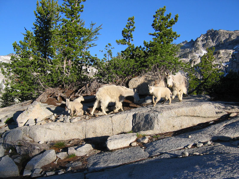
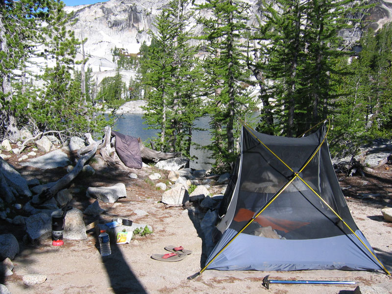
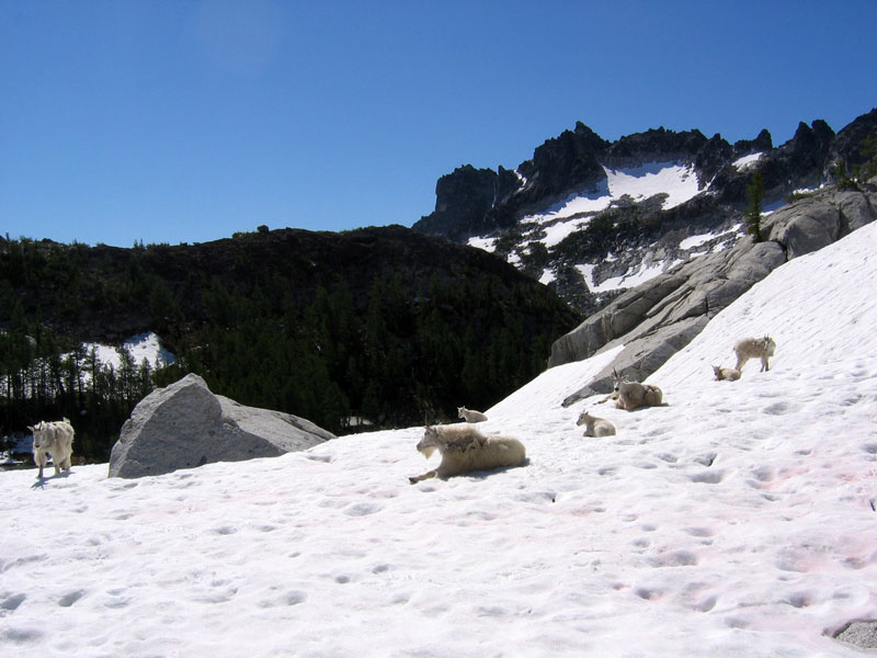
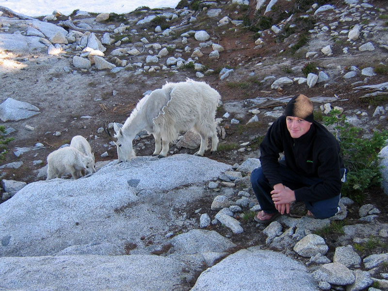
After sleeping somewhat fitfully through a windy night, I woke the next morning just before the sun began to peak over the horizon. McClellan Peak was glowing and I was itching to get a summit under my belt. I said good morning to our goat friends, then grabbed a couple of granola bars and headed toward McClellan.
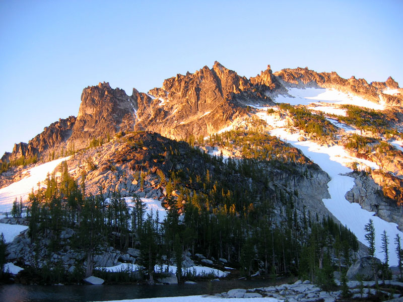
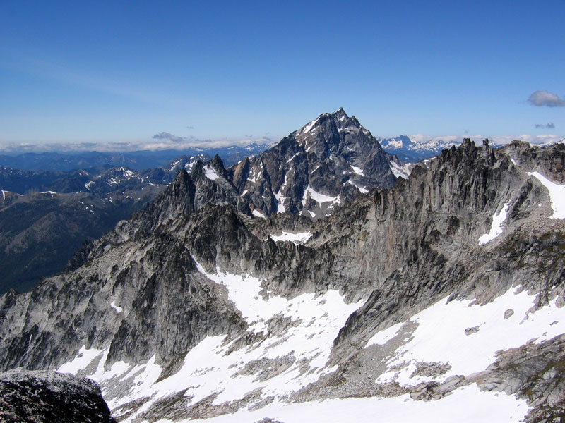
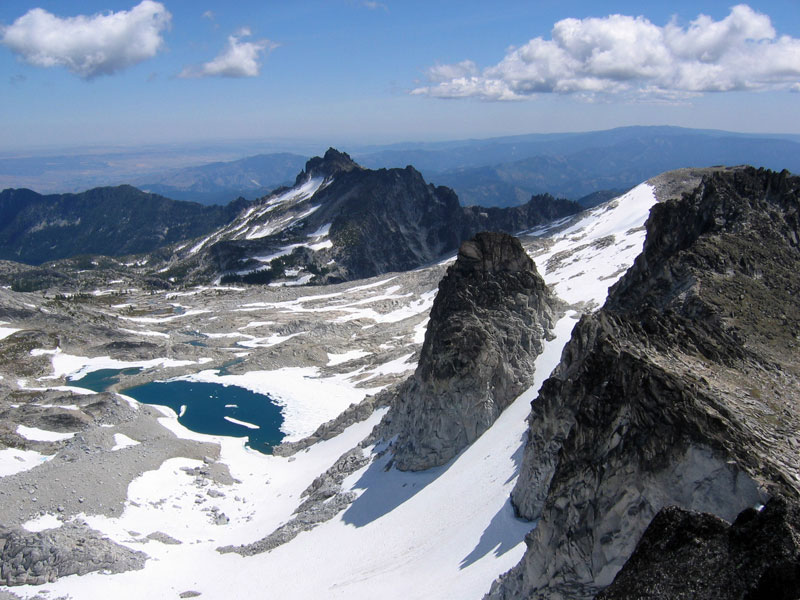
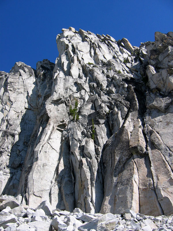
In the shade, temperatures were near freezing but I was comfortable hiking in shorts, a fleece, and a hat until reaching the sunlight. From the start, this climb had me completely entranced. Warm morning light splashed across the granite, rock slabs perched precariously overhead, ridiculously blue skies, a challenging scramble where I was forced to make route decisions, and initial sweeping views of the entire Enchantments vicinity. I ended up picking a line that took me right past the spires looming overhead. I was a little confused when I found a sling (piece of climbing protection) partway up my route as it didn’t seem terribly challenging, but looking down did reveal a fair bit of exposure. And when I straddled the ridge a vertigo-inducing drop loomed on the other side. After passing the spires I topped out on a grassy plateau which very well could’ve functioned as one of the world’s greatest picnic spots (bottom right picture). Surrounded by flowers, Mount Rainier in the distance.


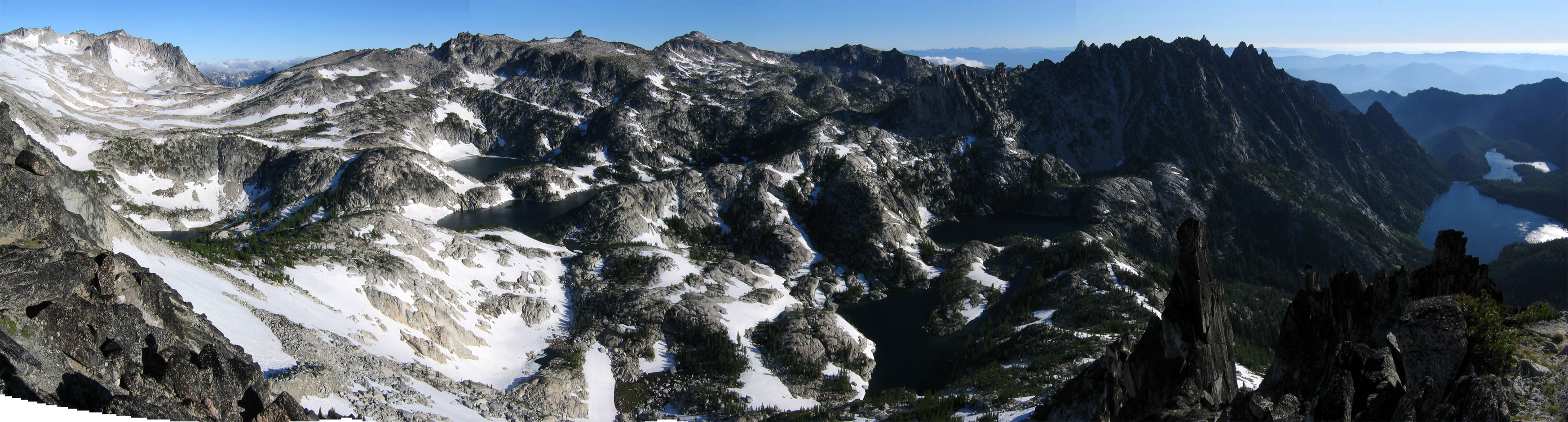
I snapped a bunch of pictures from here (including this panorama of the Enchantments) before heading up a very fun finishing scramble to the summit (elevation 8347 ft). I signed the summit registry, basked for a few minutes then headed back to rustle up some breakfast.
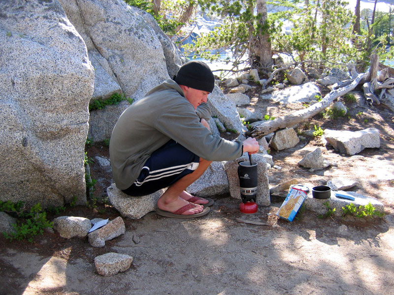
On the way back down I took a spill down a slippery patch and unbeknownst to me lost my camera in the process. I didn’t notice it was missing until I had hiked another ten minutes. I ended up having to backtrack uphill and felt quite fortunate to locate the spot where I had gone down (I found a tree I had kicked to get the mud off my boots and backtracked from there). Back in camp I cooked up some cheesy broccoli noodles and picked out my next hike.
I decided to head roughly in the direction of Little Annapurna and Dragontail peaks, knowing that I would probably opt for the more challenging Dragontail climb, but still keeping my options open depending on how the day played out. Heading west from camp the terrain stayed consistently mesmerizing and I probably could’ve been reasonably content to stay at any given location enjoying the scenery all day.

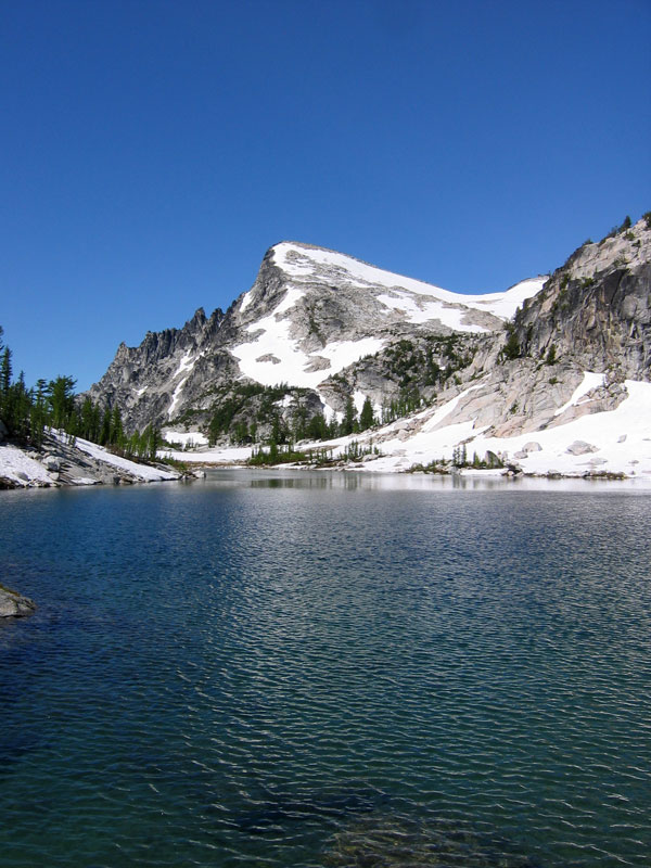
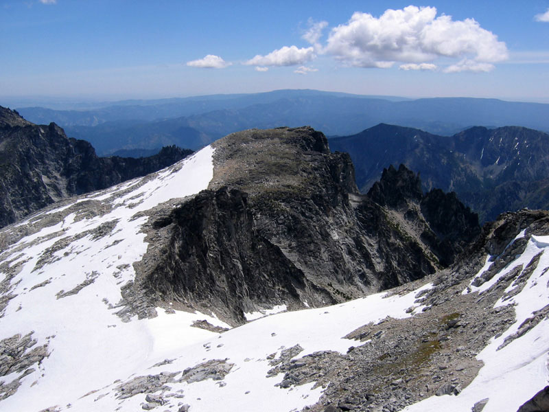
In the distance across Perfection Lake is Little Annapurna. A walkup peak in the purest sense and nothing like the real Nepalese Annapurna, but still gorgeous.
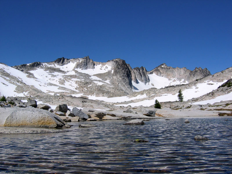
While I was up McClellan the goat family migrated uphill, or maybe it was a different family (McClellan in the background). I bumped into them again on my way toward the upper basin. Below right: looking across Inspiration Lake toward Prusik Peak.

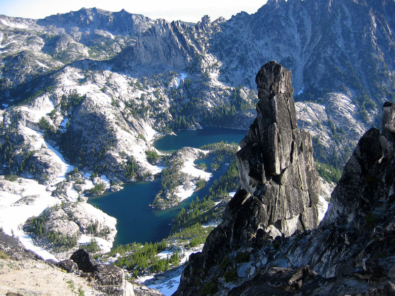
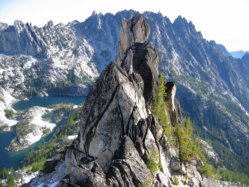
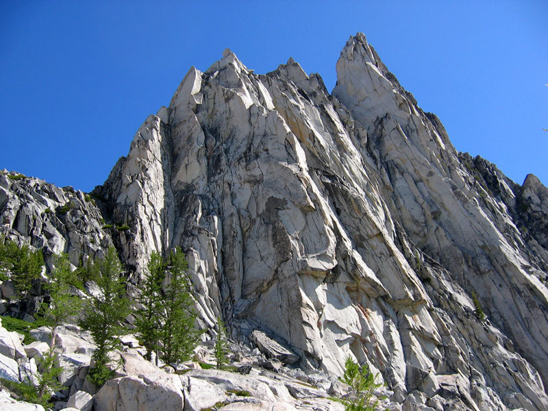
The upper basin of the Enchantments proved to be equally dazzling, surrounded by rock, snow, and patches of glacial water. I accidentally left my sunglasses in camp and realized early on that this was going to affect my climbing routes for the day. Gleaming snow fields would have to be avoided. But hey, any excuse to climb steep rock is a good excuse. Left: Witches Tower is the tower in the center, to the left of this is East Dragontail and to the right is Dragontail. Right: looking across Isolation Lake at Witches Tower, East Dragontail is off to the left. I’m not sure if East Dragontail is an official name or not, but that’s what a guy I talked to called it, so that’s what I’m rolling with.
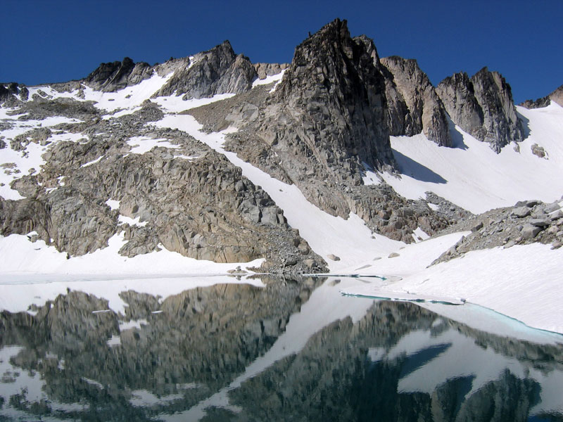
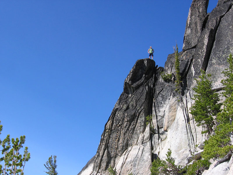
From a distance the rock at the base of Witches Tower looked plenty scramble-able so I circled around Isolation Lake with the intent of following the rock up to the higher ridge above. Up close there was a good bit of loose talus, some of it saturated with meltwater. Some fun scrambling to be had on the larger boulders but I also had to be somewhat wary of the grabbing a loose piece of rock as a handhold. When I reached the col between Witches Tower and East Dragontail I had hoped that an obvious route would present itself, but no clear paths were readily apparent. As I looked around I felt pretty sure that going straight up was not the normal route up to the ridge, but didn’t feel like hiking laterally to find an alternative. So I went straight up. Super steep but also full of solid grippy handholds and footholds. I kept at least three points of contact as much as I could and only really felt a little unsteady when hitting patches of lichen-covered rock. You can see the steepness and lichen-covered rock in the picture on the right (taken looking down about halfway to the top). Some adrenaline-charged moments but that made reaching the relative safety of a flatter summit even more rewarding.


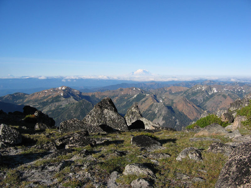
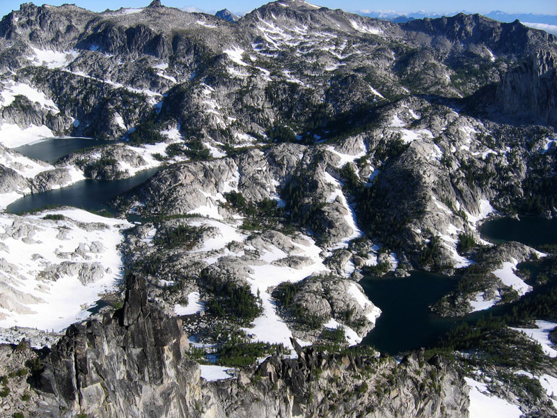
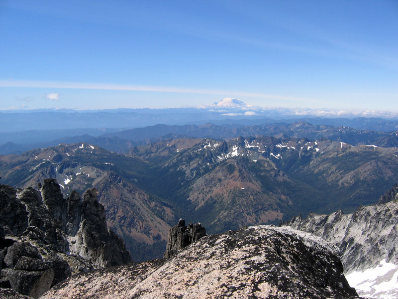
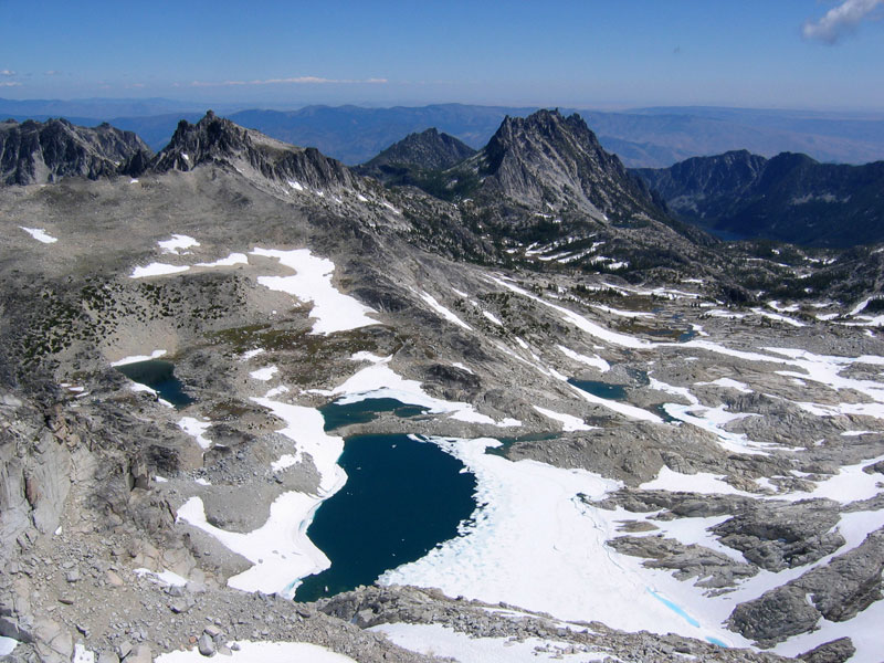
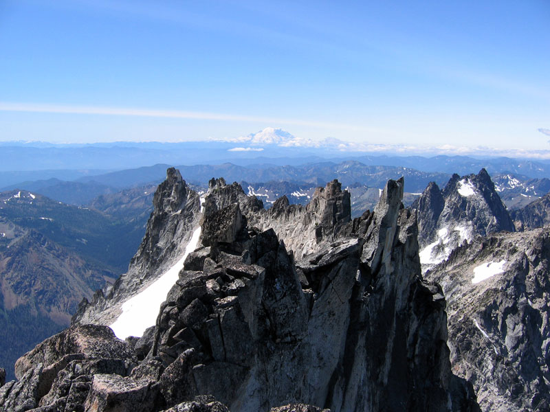
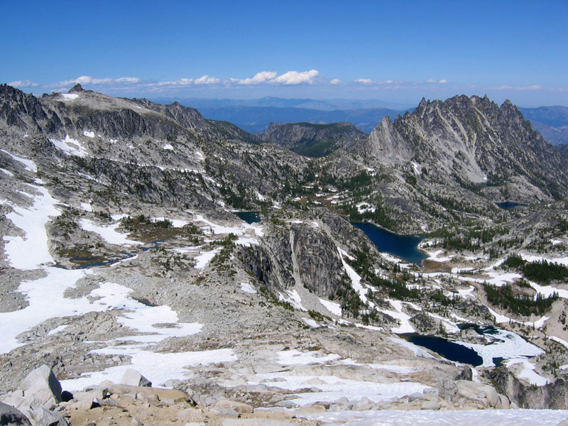
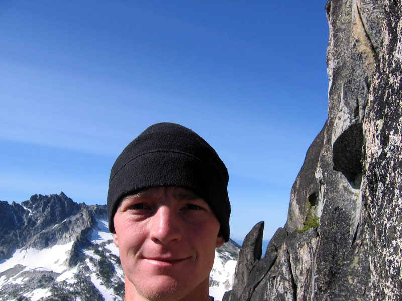
The next four pictures were taken from the summit of East Dragontail. Top left: Mount Rainier in the distance. Top right: Enchantments basin, Isolation Lake below, Prusik Peak and The Temple in the distance. Bottom left: Mount Stuart (which I went up last October). Bottom right: Little Annapurna.
From East Dragontail I skittered down the much gentler south side, crossed the saddle over to Dragontail, and followed a well-worn path up to the summit (elevation 8840 ft) where a couple of people were just leaving. I talked with them long enough to find out that Witches Tower was a doable scramble and then they were on their way down Colchuck Glacier. While I was relaxing for a few minutes on the summit, a couple of climbers standing on top of Witches Tower bellowed at me from across the void. “Hey! Hey you on Dragontail! Wooooo!” I couldn’t help but laugh at their enthusiasm and waved back.
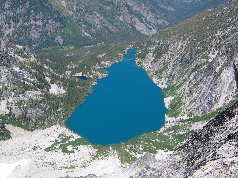
Pictures from the summit of Dragontail Peak. Top left: The “tail” of Dragontail. Top right: Colchuck Lake. Bottom: Witches Tower and Isolation Lake, McClellan Peak in the background.
I briefly toyed with idea of continuing to follow the ridge west over to Colchuck Peak but my legs were telling me otherwise, so I retraced my steps back up to East Dragontail. I found a well-travelled route down west of the summit and followed this back down, wrapping back around toward Witches Tower.


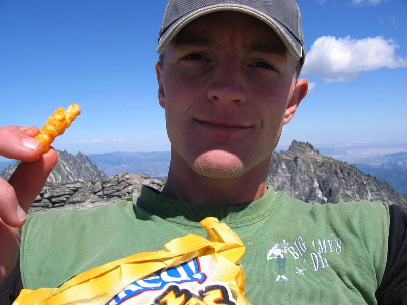
The route I took up Witches Tower was a class 3 scramble but it looked like there would be many more amusing climbing options if you came equipped to do so. The views of course were spectacular but I was getting pretty tired and was feeling ready to put something resembling a meal into my stomach, so I didn’t stay long. Little Annapurna Peak was roughly on the way back to camp so I decided to pick off one last summit before calling it a day. I followed the footsteps of the guys who had earlier hollered at me from Witches Peak and tromped across Snow Creek Glacier before ascending the gentle upslope of Annapurna. Cheetos on the summit (elevation 8440 ft) were my reward and another stellar view.
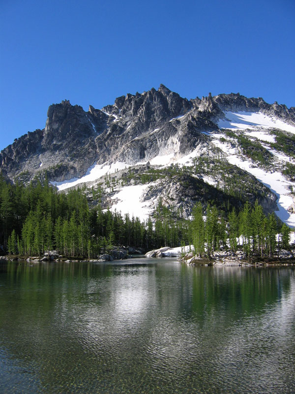
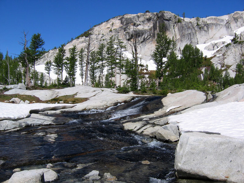
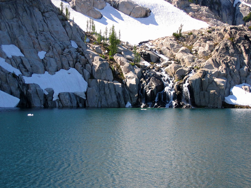
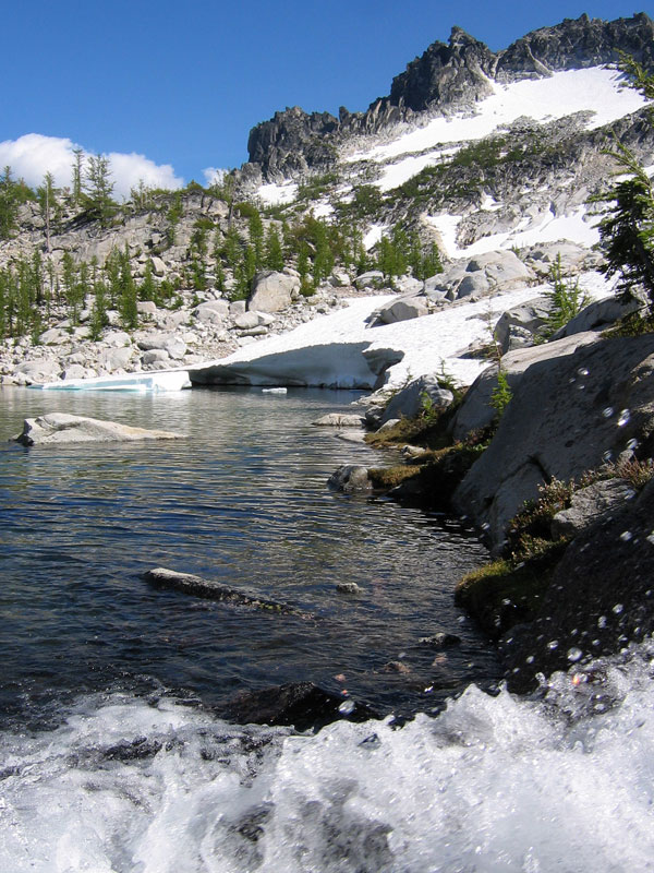
Rather than take the trail I had come up earlier in the day I decided that it looked slightly shorter to try to drop down to Crystal Lake (the lake in the bottom right corner of the right-hand picture above) and cut across. This didn’t work out too well as I ended up bushwhacking and clinging to pine trees as I slid down trail-free slopes. In the end I’m pretty sure my shortcut took longer than if I had just followed the original route. But then that’s what shortcuts usually do. I did get to enjoy a gorgeous view of the snowmelt plunging into Perfection Lake (below left). Right: Sprite Lake with McClellan Peak in the background.
Finally back in camp I devoured a box of spiral mac and cheese slathered in pasta sauce, then relaxed watching mountain goats and reading for the remainder of the evening.
Saturday July 19, 2008
No wind last night and I slept like a rock. Last day on our Enchantments permit and a long hike out to look forward to, but I still wanted to run up Prusik as far as I could get without climbing gear. I ate a hot breakfast, broke down camp, then stashed my pack and headed up the south side of Prusik Peak. A little eerie looking up at all those dangling slabs of granite. I imagine it’d be some gorgeous crack climbing though. I made it to the highest ridge below the final summit spires and knew there was zero option of safely going further. Straight up. Kind of nice when the decision is that clear-cut.
Back at my pack I cooked up my last box of cookable food, cleaned up, and began the long hike back to the car. The hike out seemed to take forever, thump thumping down an endless trail and next time I’m sure I’ll opt for the shorter steeper trail in via Aasgard Pass. All told though it was a superb weekend in possibly the most beautiful piece of wilderness I’ve ever hiked through.
Magnificent scenery. How much of the year is this area accessible? It looks like there is year round snow.
June through October is the best time to go weather-wise, but I think as long as the road to the trailhead is plowed you could still get in in early or late season. The trails might just be a bit messier or nonexistent.
Beautiful pictures, Josh. Question for Mary? Do you worry constantly when he is out hiking!!/??
Wow, Josh. You leave me speechless. The intensity of living you pack into a weekend surviving on your cheetos and pasta. You’ve seen and experienced so much.
Well, he is considerate enough to leave a map behind with an X, marking “I’m here.” At least that way I can report his general whereabouts if he goes missing. All joking aside, yeah, it can be a little unnerving at times. If he goes by himself (which is often), it’s kind of bothersome. What can I do though?
Good question – What can I do though? You are right – there is no good alternative!!! You’re a good wife, Mary. Maybe you should come visit So. Cal sometime and we can do something relaxing – like go to a spa or something. :)