After seeing Mount Stuart looming on the horizon on the way to a work meeting in Cle Elum, WA last week I decided to sneak in one more hiking trip before the weather turned too winter-y. I checked the weekend forecast as soon as I got home and saw a cloudless sun hovering over a “60” for Saturday and started to pack my hiking pack.
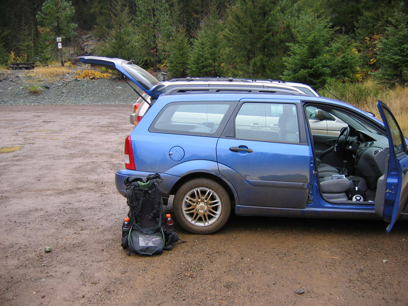
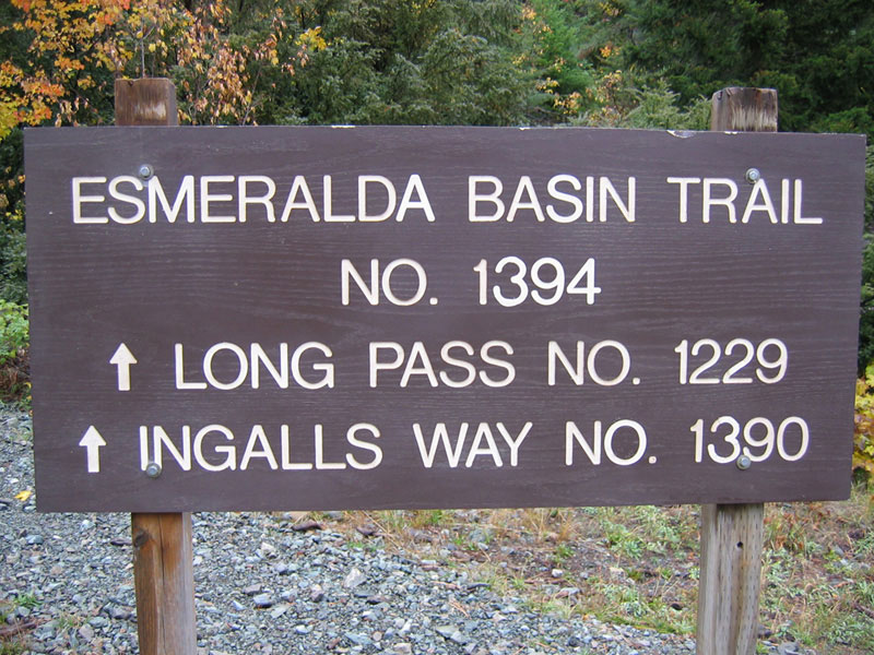
Late Friday morning I loaded up my car under a light rain and drove the eighty-five miles to the Esmeralda Basin Trailhead. At the trailhead I geared up and briefly talked with a guy who cautioned that there were eight inches of snow on Stuart (this would turn out to be only partially true as there were actually eight inches of fresh snow over top of a hearty layer of older snow).
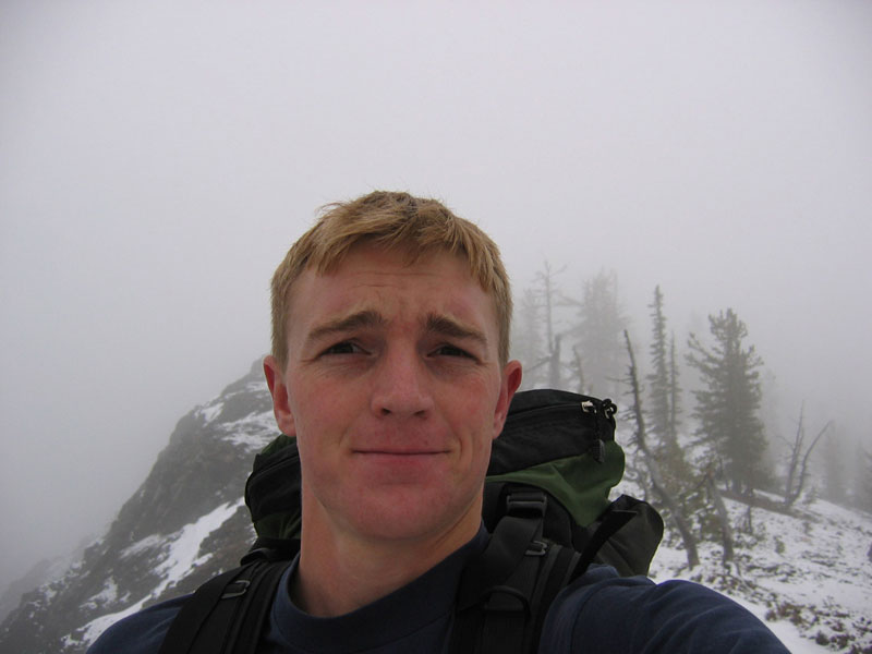
I made good time marching up the switchbacks toward Longs Pass, but was a little frustrated by the thick bank of clouds limiting visibility all around me. I mean, it was interesting and pretty in a “I hope I don’t get struck by lightening” sort of way, but definitely created some navigational difficulties. I had a topo map with me that showed a trail running from the trailhead to the crest of Longs Pass, but then nothing from Longs Pass to foot of Stuart. I figured this was a popular enough area that there would be some sort of unofficial trail from Longs to Stuart. When I looked down from the Pass I could see that indeed there was a trail, but that it was also covered in snow and very much footprint-free. Mount Stuart was also completely obscured. So it was with a bit of an eery feeling that I dropped down the other side and tromped into woods that seemed far too quiet. Covered in snow and cloud.
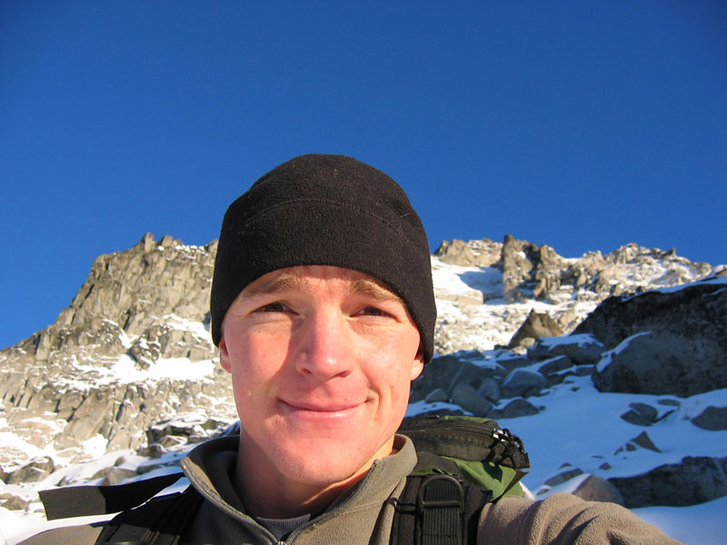
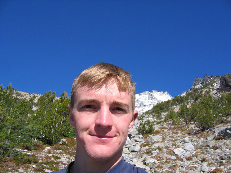
Self picture on top of Longs Pass and view down from Longs Pass:

I looked back frequently trying to track landmarks and placed a few cairns, but as it turned out the trail stayed strong enough that I think I could’ve made my way back without too much trouble. I eventually hit Ingalls Creek and (bouncing from rock to rock to cross the creek) an official pack trail just on the other side. I headed east on this trail for less than a mile before hitting a bit of a clearing and deciding to step off the trail and cut north toward the mountain. I had initially planned to camp in the creek basin, but after bushwhacking and clawing my way through a swath of shrubbery, the rock on the other side was too irresistible. I ended up scrambling up the mountain for the rest of day.
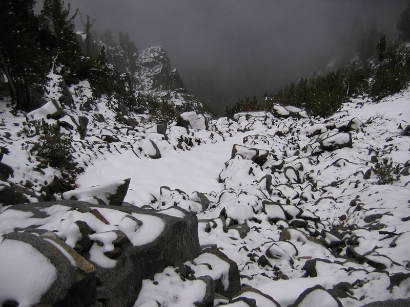
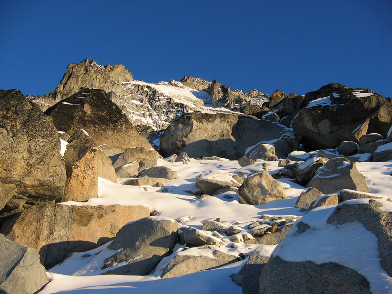
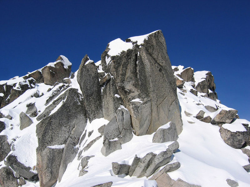
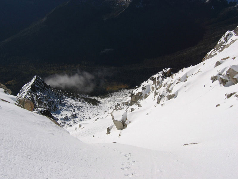
An early rejected camp site and a view down snow covered rocks from the way I came up:

The rock was much steeper than I anticipated (and I would later discover that I had charged up Ulrich’s Couloir instead of the more gentle planned route up the Cascadian Couloir). Every thirty or forty minutes or so I’d bump into an area that seemed flat enough to hold a sleeping bag, if not a tent, and every thirty or forty minutes I’d look up and think, “Well maybe just a little further.” Eventually though, darkness, coldness, and rationality took over and I stopped for the day after stumbling onto one of the cooler camping spots I’ve ever found. Nestled between two giant boulders, with just enough room for my tent, and a panoramic view of Mount Rainier in the distance.
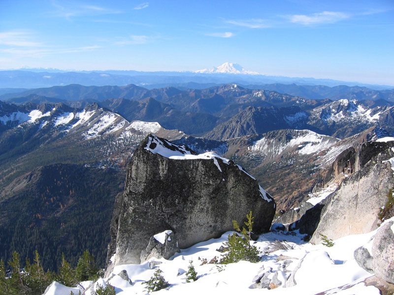
A view of my camp site in the fading light of day one and a view in full sun the next day:
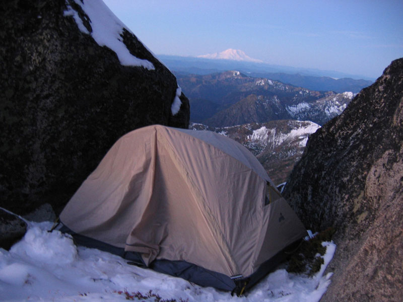
Of course it was also covered in snow. And I forgot to bring any sort of tarp or sleeping pad. So as the snow melted underneath me, soaking into my tent and then my sleeping bag, I ended up shivering away much of the night.
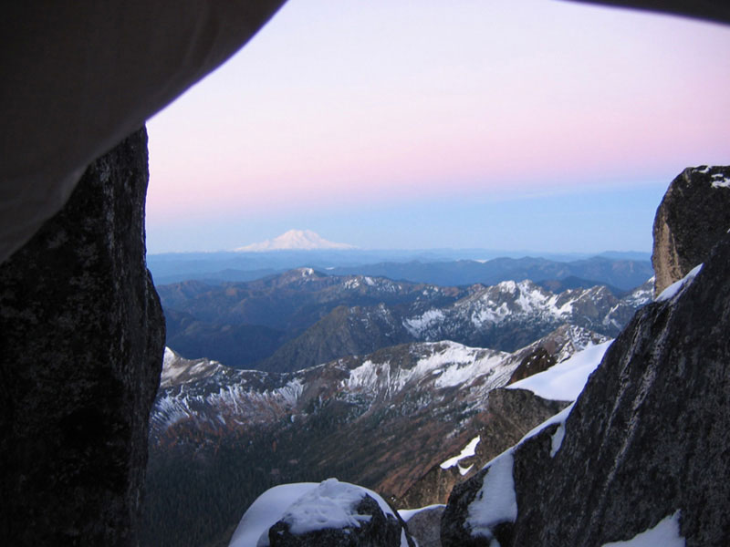
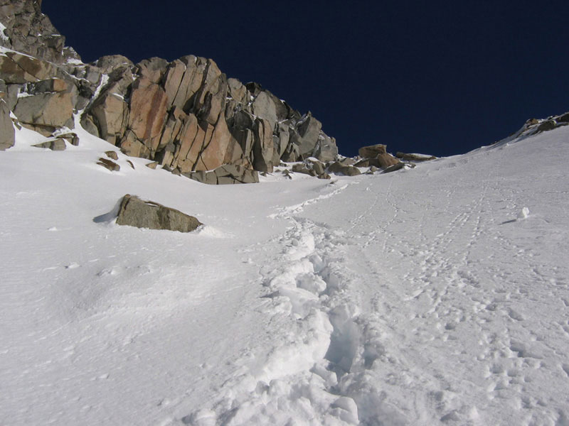
View from my tent door and melted snow where I slept:

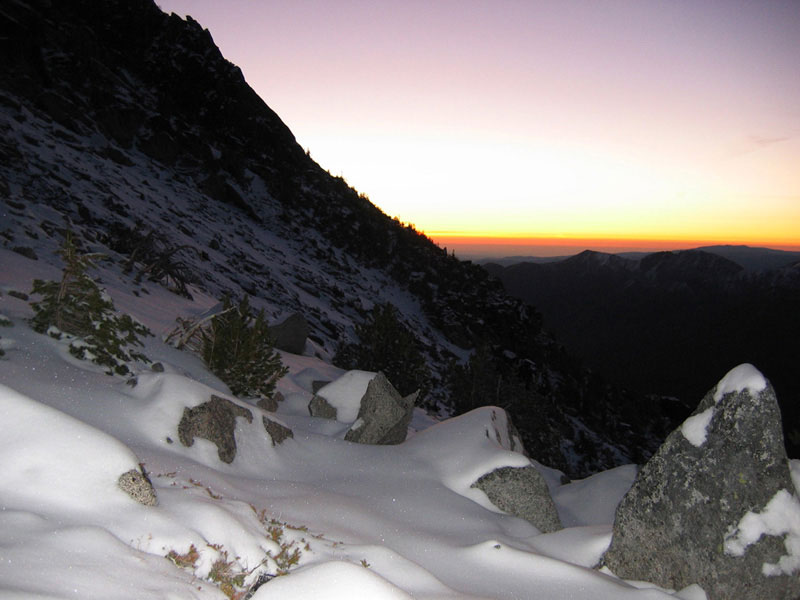
I woke early the next morning, watched the sun rise into a cloudless sky, and tried to thaw out my frozen boots (by sitting on them). This was also really the first time I was able to take in my surroundings. I still had no idea how close I was to the summit or even where exactly on the mountain I was located. After breaking camp, eating a bagel, and chugging some Gatorade I started kick stepping my way upward. I was finding much less rock and much more snow than on the previous day and fairly frequently one of my legs would plunge thigh deep through the crust. I also had to stop after about half an hour to pull my frozen toes out of my wet boots and give them a chance to warm in the sun. Before continuing on I wrapped my liner socks in plastic bags and pulled my wool socks over the bags (reminded me of sledding with bread bags under my shoes when I was a kid). This kept things plenty toasty the rest of the way. And the sun really was plenty warm. Enough where I felt my face beginning to glow with an early sunburn and where I was down to a t-shirt by mid morning.


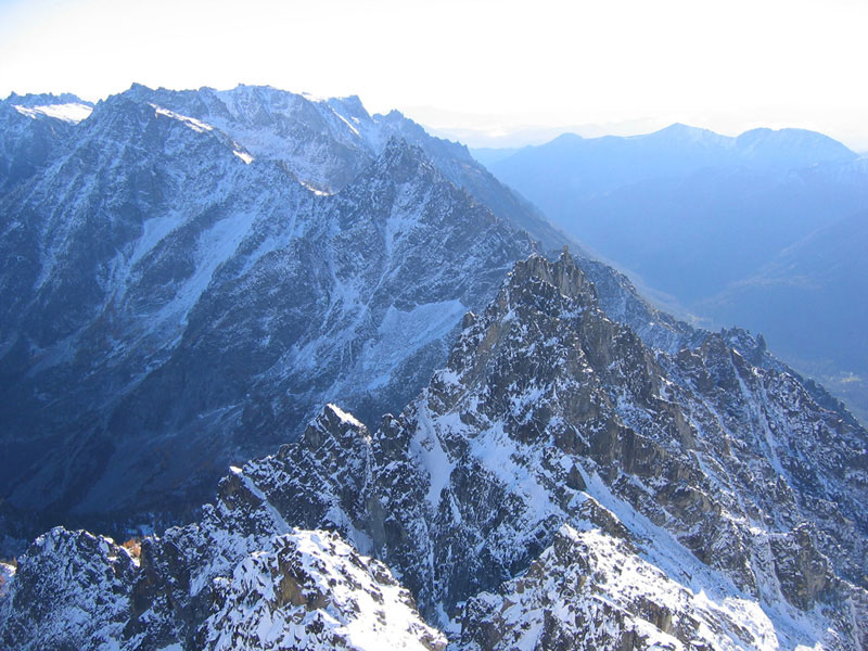
While the day was cheery, the terrain was less so. I worked my way up steep slopes, occasionally on all fours and frequently relied on my ice ax to keep from back sliding. After a couple of hours of struggling though I reached a ridge just beneath the false summit. Eye-popping vistas in a nearly 360 view. I realized almost immediately though that that was as high as I was going to climb that day. Extending up from the ridge was a steep section of rock covered in thick melting snow and dropping down was a gigantic exposed void. The kind of drop where, to have a look, you crawl to the edge rather than walk. In summer I think I definitely would’ve felt comfortable with the footing heading up. Or possibly even in the current conditions with someone else there to watch my back. But not by myself when I hadn’t seen another footprint in two days. Not with so much slipperiness and so much exposure. So close! I felt a little pang of regret, but this passed quickly in the face of so much common sense. So I spent about fifteen minutes enjoying the view and taking pictures and then followed my own footsteps back down the mountain. (I did however make a small traverse near the ridge, just to check things out. Just to be sure.)


On the way down I briefly entertained the thought of glissading, but after slipping and self arresting a couple of times with shoulder-wrenching violence, I decided to just stomp my way down. Obviously this went much much quicker than on the way up and I was able to pick much smarter routes from the higher vantage point (I was also able to locate the Cascadian Couloir that I had missed on the way up). Lots of neat scrambling, gorgeous weather, gorgeous views. Good, good, good.

Then I hit the treeline and promptly got lost for the next hour and a half. I was smart enough to head straight back toward Ingalls Creek and did manage to find what looked like a major trail. But then, making grand assumptions based on my cloud-covered wanderings from the previous day and badly misreading my bearings, I headed in the wrong direction down the trail. I eventually realized my mistake and actually took some time to locate myself. Retracing my steps I discovered that I had come down the mountain only about 500 feet from the trail that would’ve led me back up Longs Pass. Good work.
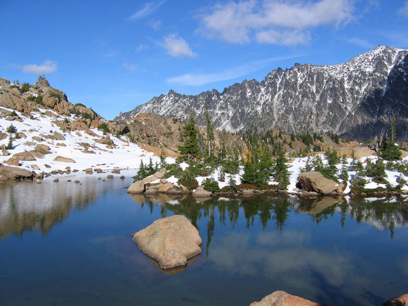
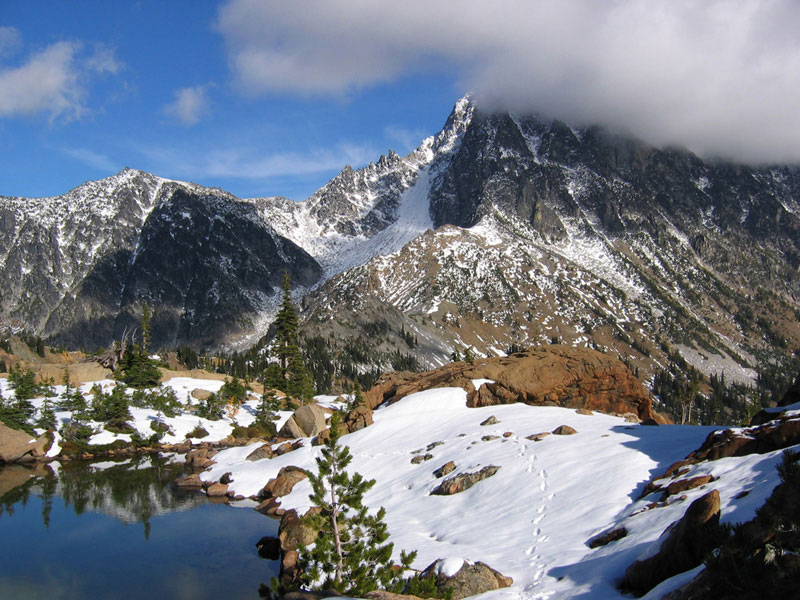
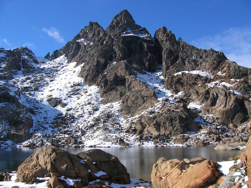
But even with the lost time, the day was still young, so I opted for a circuitous route back to my car that would take me up near Ingalls Lake and Ingalls Peak. This turned out to be an exhausting slog through slushy snow, but did result in some poster-worthy scenery. Ingalls Lake was fairly bustling with humanity compared to my last twenty-four hours and seemed to be a popular day-hike destination from the Esmeralda Basin trailhead.

As pretty as it was though, I didn’t stay long as I was kind of lurching about at this point and ready to drink the last Gatorade stashed in my car. If I had had more time/patience it would’ve been nice to hang out and stare at Mount Stuart for a while. The 2000 feet of descent from Ingalls Pass were not kind to my knees and I very much enjoyed being able to sit for an hour and forty-five minutes on the ride home. Home being the place where my wife most graciously had huge portions of fajitas and rice and beans waiting for me when I walked in the door. Great weekend.
More pictures in the photos section.
Wow, that looks cold… what’s the temperature rating on your sleeping bag? Still planning on HI in a couple weeks?
Rated 25 degrees. Normally warm enough, but not when sleeping in a puddle I guess. HI should be a bit nicer.
Huh, I think mine’s rated either 10 or 15, and I’m freezing if it’s 50 out.
Just incredible, Josh. Glad your common sense was working for you those days on the mountain.
Pingback: slipperyamoeba.com » Blog Archive » Mon 8 Sep 08
Pingback: slipperyamoeba.com » Blog Archive » Sun 23 Nov 08