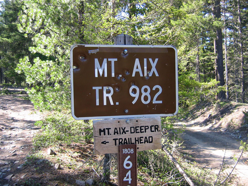
A little belated, but here’s my Mt Aix trip report from May 24.
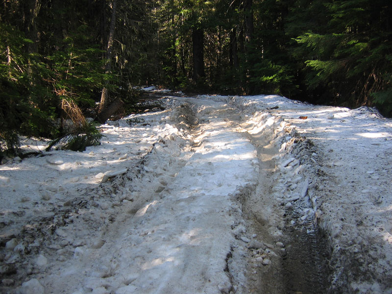
A couple weeks ago the Forest Service road to the Mt Aix trailhead had been under piles of thick snow. I nearly stranded my car in slushy mud puddles before reaching this thick snow for a bit of hiking with the dogs. As I rolled up at 8 in the morning two Sundays ago though, almost all of that snow had melted out, leaving dry road and just a couple of relatively short stretches of frozen hardpack in the shade. The Focus barely cleared the first stretch, the underbody scraping lightly as I gunned it past. It did not clear the second, grinding to a stop thirty feet in. No going forward, no reversing, the car sat perfectly perched on a layer of ice in the middle of the road. Well, this is going to cut into my hiking time. I immediately got out and started kicking the snow I could kick and hacking away at the snow under the car with a log like a Neanderthal.
After about half an hour on hands and knees, and much blood loss from the bludgeoning of my knuckles, I remembered that I had my ice axe in the back of the car and this sped up the hacking process tremendously. I then proceeded to wake the forest with a noisy cycle of repeated engine revs as I painstakingly reversed course back onto dry road. In total I was setback an hour, but I suppose it could’ve been worse. I parked my car on the side of the road and hiked three quarters of a mile to the trailhead.
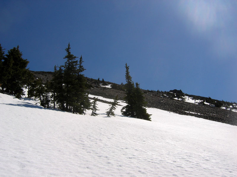
Less than five minutes after I started hiking a pickup truck and a Subaru Outback came zipping past, evidently clearing the same stretch of snow I’d been stuck without any issues. I was happy to find the early part of the Mt Aix trail to be dry as it switched-backed upward through the alpine-covered side of Nelson Ridge. There were patches of snow where the trail lost its tree cover, but not enough to soak my feet until about halfway up the ridge where the trail completely disappeared.
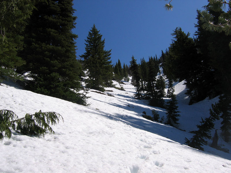
Now off the trail, I followed a gully up, figuring that would be my best bet for finding my way back if need be, and was happy to stumble onto a single set of foot print in the frozen snow. Happy because one, this seemed to be a good indication of heading the right direction, and two, it meant I didn’t have to kick my own steps in the steep snow slope. Forty five minutes later, I met the owner of the footprints as he came glissading down the slope. A few minutes after that I reached his campsite and my footprint guide ended. The late morning sun had started to soften the snow just enough though, so that even without crampons my footing was reasonably solid. I wished I had brought a topo map as I broke the treeline and tried to decide on a direction. I opted for straight up and took careful stock of my location as I headed for the exposed scree slopes above the snow.
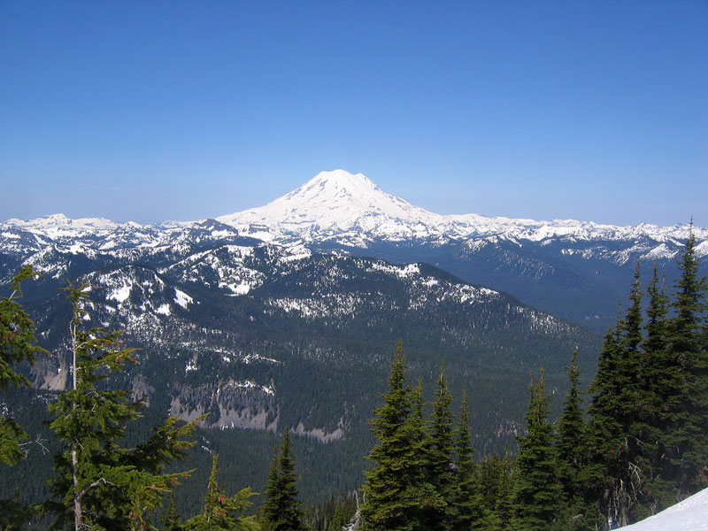
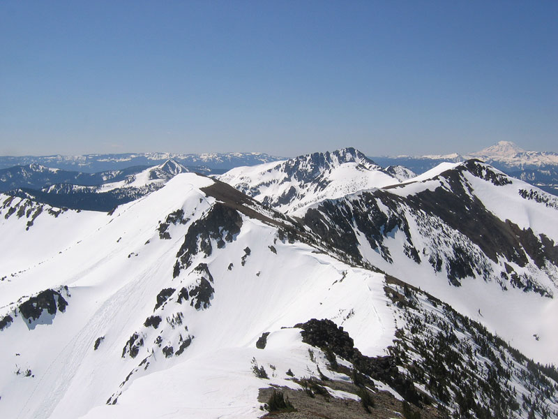
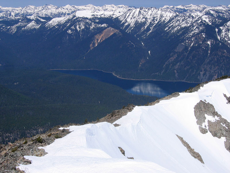
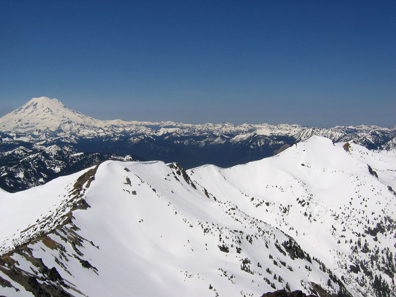
I would later learn that the correct path follows a gentler traverse to the south. The scree was exceedingly unpleasant, saturated with meltwater and constantly shifting around my feet as I clawed my way up. Two steps up, one slide back. It was absolutely worth every ankle roll though as I topped out on the high point of Nelson Ridge (elevation ~7550 ft) to one of the nicest panoramas I’ve ever seen. Click the image below for a labeled full 360 degree view:

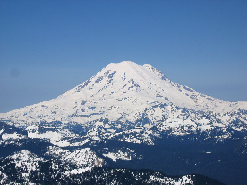
Rainier dominated right in front of me, Bumping Lake shimmered down below, Adams, St Helens, and the Goat Rocks stood out to the south (fronted by Birmarck Peak), the Stuart Range was stark to the north, and following the ridge Mt Aix loomed a couple miles to the southeast.
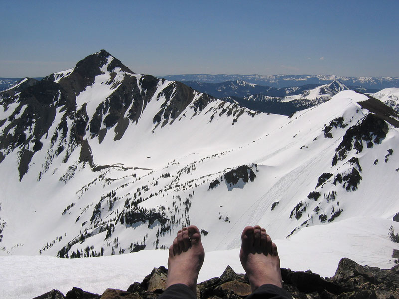
I had been pouring sweat coming up, but now with a light breeze blowing at the peak I pulled on a light fleece and wind pants then sat down to refuel and relax. I finished the second of three peanut butter and jelly sandwiches that I’d brought and knocked back a package of Sour Patch Kids eXploders, then contentedly stretched out, enjoying the solitude of my vantage.
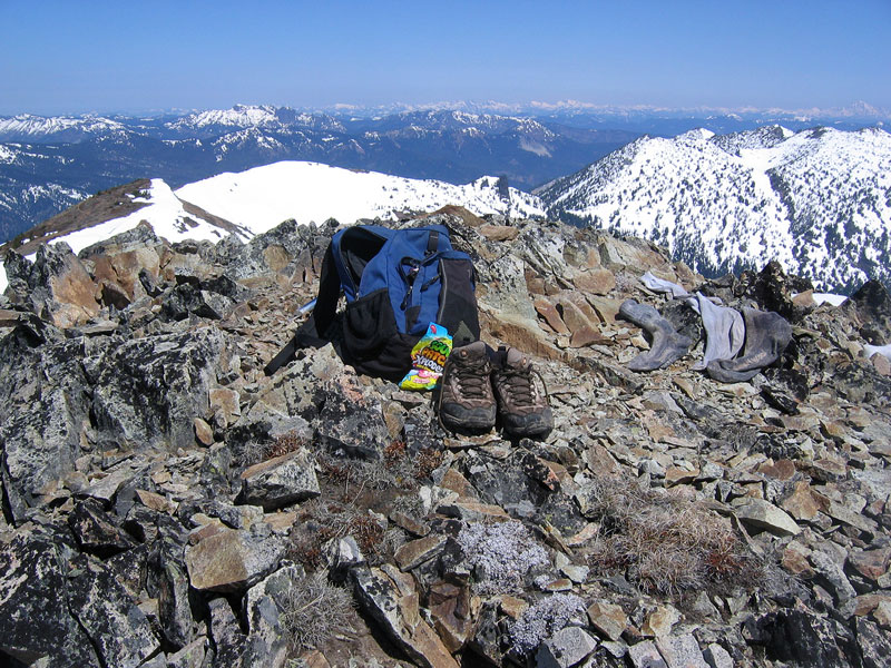
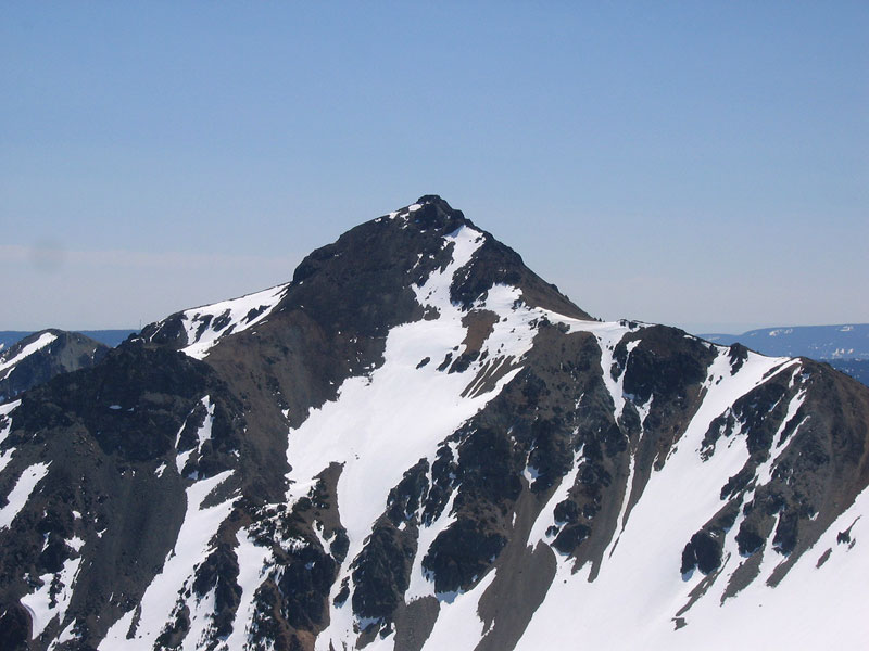
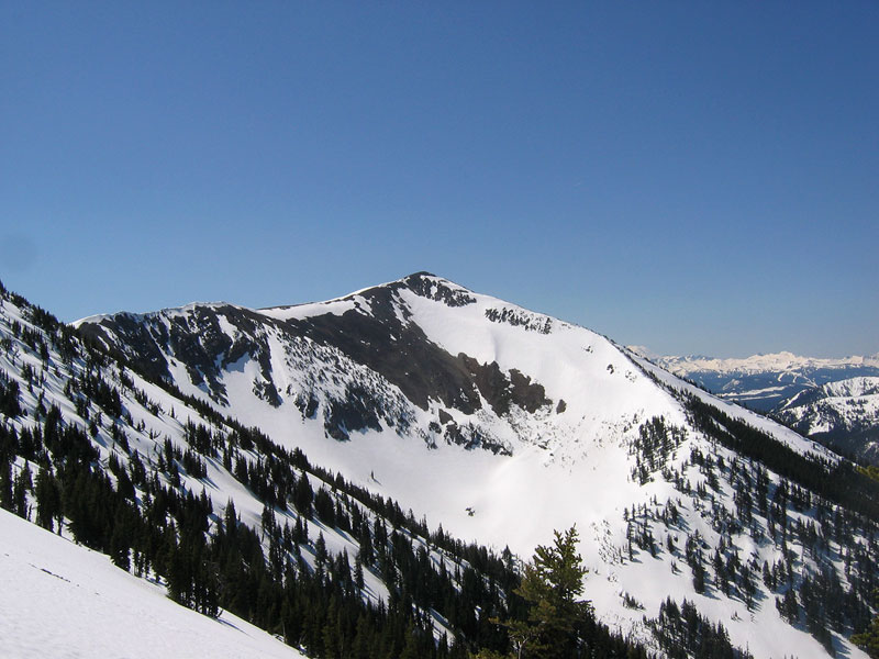
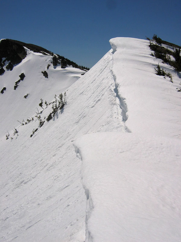
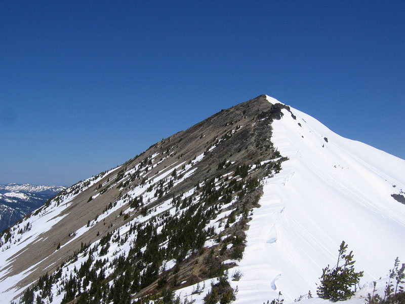
In my head I started to call it a day, rationalizing that the goal all along had been to get some exercise and see something beautiful (how could it get much better?), and not necessarily to climb an official summit. Mt Aix looked to be another hour of hiking away and I had dogs at home waiting to be let out. So I sat at my assumed final destination for about half an hour letting my snow-soaked feet dry out for the home trek. But, as so often happens curiosity got the best of me. First I just wanted to take a closer look at the cornices perched lower on the ridge like shark fins (left picture below). Then, well, I’m almost at the next peak, let’s see what’s up there. Then, ah who am I kidding, let’s just run up to the top of Aix real quick. The right picture below is looking back at the Peak on Nelson Ridge where I had been relaxing.
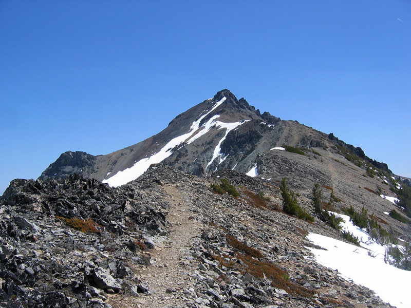
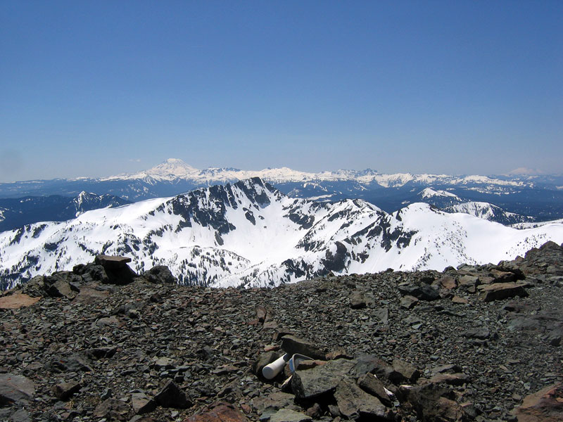
Friends who I’ve hiked with I’m sure will tell similar stories. I have plenty of past experience that tells me that I’ve never regretted just going a little further. So I scrambled up to the top of Mt. Aix (about 45 minutes from peak to peak). The views were roughly the same as from Nelson Ridge, obviously minus the view of Mt Aix and plus the view of the ridge. Left top: Looking up at the trail to the Mt Aix summit. Right top: view from the summit looking toward Mt Adams. Left bottom: Nelson Ridge in the foreground with Rainier behind. Right bottom: Mt Aix, elevation 7766 ft.
I stayed about five minutes then trotted back down the slope. Back on the ridge the solitude was finally broken when I met a couple with a Golden Retriever (with little red dog boots on) lounging in the sun. I talked with them for a few minutes before following their footsteps (on the correct trail bearing) down the west side of the ridge. I made good time plunge-stepping through the now soft snow back under the tree line, then jogged most of the way back to the trailhead. 90 minutes from the Mt. Aix summit back to my car.

